Dakhla, New Valley, Egypt · 25.192° N, 29.124° E · 354 km west of the Nile
Sheet revision 1
The water
Drawn from Nubian Sandstone Aquifer Systemas of Rev 1Every litre lifted here fell as rain before agriculture existed.
The farm sits over the Nubian Sandstone Aquifer System — fossil water, not meaningfully recharging. The nearest Nile channel is 354 km east. There is no surface water here and there is no second account.
The aquifer
Drawn from owner confirmation · surveyed KMLas ofFossil water is a stock, not a flow.
Two things are true at once and this page says both. The wells are drilled and operational — the owner confirmed it on 2026-08-16, and everything written here about them is in the present tense. And the water they lift accumulated before anyone had thought to farm, and is not meaningfully recharging on any timescale a company can plan against.
So the word this plate does not use is sustainable. What happens at Dakhla is the conversion of an ancient stock into a present one: food, in a place that cannot grow it from rainfall. That is a defensible thing to do. It is not a defensible thing to dress up, and a green gradient over a sunset is how every other operator dresses it up.
The consequence for this website is narrow and specific. Every claim about the water has to be a measurement or it does not appear, because the visitor who can check it is the one this page is written for.
Operational, and unpublished. The status is a fact; the number is not yet one.
Not yet published
Depth, static water level and screened interval are absent from this page, and no depth section is drawn anywhere on this site. No drilling log has been handed over. A stratigraphic drawing invented to fill the space would be the one thing here that a rig report could catch out.
Exhibit I
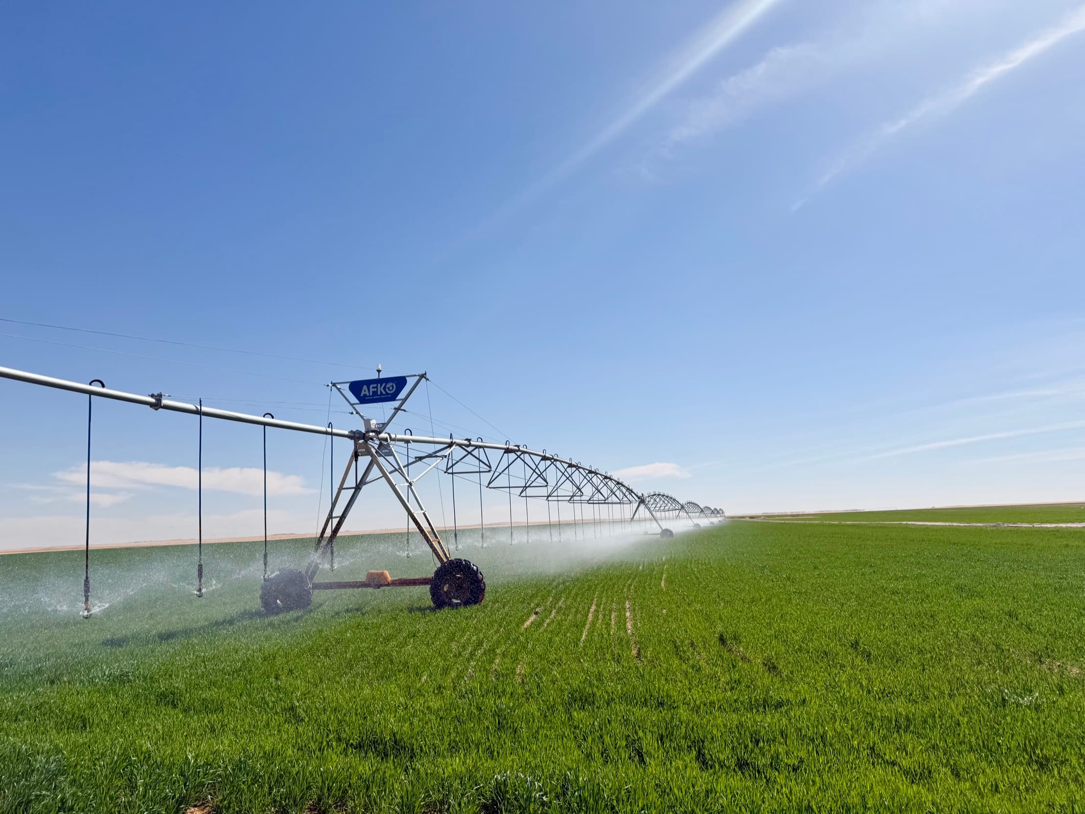
Everything green in this frame is lifted water. Nothing here is rain-fed, and the line where the irrigation stops is visible from orbit.
The count
Drawn from brief · fixed-asset register · surveyed KMLas of Rev 1Six sources. No agreement.
One Arabic word does the damage. بئر means well, and in the company's own production and sales exports it is also the label on the pivot column. So a figure quoting wells may be counting pivots, and no total reconciles against another.
Until one surveyed pivot centre or one drilling log arrives, this page prints a dash. The status of the wells is not in doubt — only the arithmetic is.
| Source | Reads | Note |
|---|---|---|
| Brief, 2026-08-13 | 34 | One figure, with no register behind it. |
| Fixed-asset register | Six, namedبئر 1 – بئر 6 | Each one carried as its own asset. |
| Buildings register | Six, pairedغرفة فنى بيفوت بئر 1-2 · 3-4 · 5-6 | Three pivot-technician rooms, two wells each. |
| Production.csv · Sales.csv | Not a well countإجمالي بئر 3 | The column heads rows labelled Pivot 3. Here بئر labels the pivot. |
| Surveyed KML | No record | The Wells and Water Lines folders were created and never populated. |
| Ledger, بئر 300 / بئر 420 | Metres of cable | Cable lengths, not wells. They have been miscounted as wells before. |
Published: status live, count withheld. The brief's 34 and the register's six are not two estimates of one number — they may be two different quantities wearing the same word.
What the register carries
Drawn from chart of accountsas ofWells — drilling, casing, consultations
الابار - حفر ومواسير واستشارات
Well pumps, motors and cables
طلمبات ومواتير وكبلات الابار
Irrigation networks and lines
شبكات وخطوط الري
Storage — absent from the register
No reservoir or water-storage asset appears among the water categories on file. Whether one exists is unanswered.
Three lines of the company's own chart of accounts, translated rather than invented. A fourth — the fertiliser pump set, طلمبات ومواتير السمادات — feeds the same irrigation lines. What the register does not carry anywhere is a quantity: no volume, no rate, no hours run.
What it lifted
Drawn from Production.csvas ofFifteen cuts across two pivots yielded 1,096 tonnes, every kilogram of it irrigated.
Two pivots have production records. Why only those two, and which season the fifteen cuts cover, are open questions — so this plate gives the tonnage and not a yield per feddan, which would need both.
The number this page most wants
Litres per tonne. It is the honest measure of a fossil-water farm and it cannot be calculated: no abstraction figure exists in any record held. When the wells are metered, it goes at the top of this plate.
Not yet published
Drawn from open items, wateras of Rev 1| Measurement | Position | Why |
|---|---|---|
| Well count | Withheld | Not reconciled across sources; in Arabic one word labels wells and pivots alike. |
| Centre pivot count | Withheld | Not reconciled between the survey and the operating accounts. |
| Depth | Not on file | No drilling log has been handed over. |
| Static water level | Not on file | Same log. Nothing in the accounts records it. |
| Screened interval | Not on file | Same log. |
| Flow rate per well | Not on file | Absent from every source held. |
| Drill and commissioning dates | Not on file | Without them the wells cannot be plotted in the order they were drilled. |
| Abstraction volume | Not on file | No metered figure exists in the records held, so litres per tonne is not calculable. |
| Depth section drawing | Not drawn | There is no log to draw it from, and a plausible-looking stratigraphy would be a lie with a scale bar on it. |
Nine measurements a water page is expected to carry, and none of them is here. Publishing the gap costs a paragraph. Filling it with a plausible figure would cost the only thing this site is built out of.
Owner confirmation · fixed-asset register · surveyed KML · as of